During our trip to southern Spain, the excursion to the Caminito del Rey hiking trail was a real highlight. The trail was previously known as one of the most dangerous in the world but after being closed for a number of years, the trail was opened to tourists in 2015 and is now completely safe, but still breathtaking. This post is the third on our journey which began in Granada where we also visited Alhambra and then continued towards Málaga.


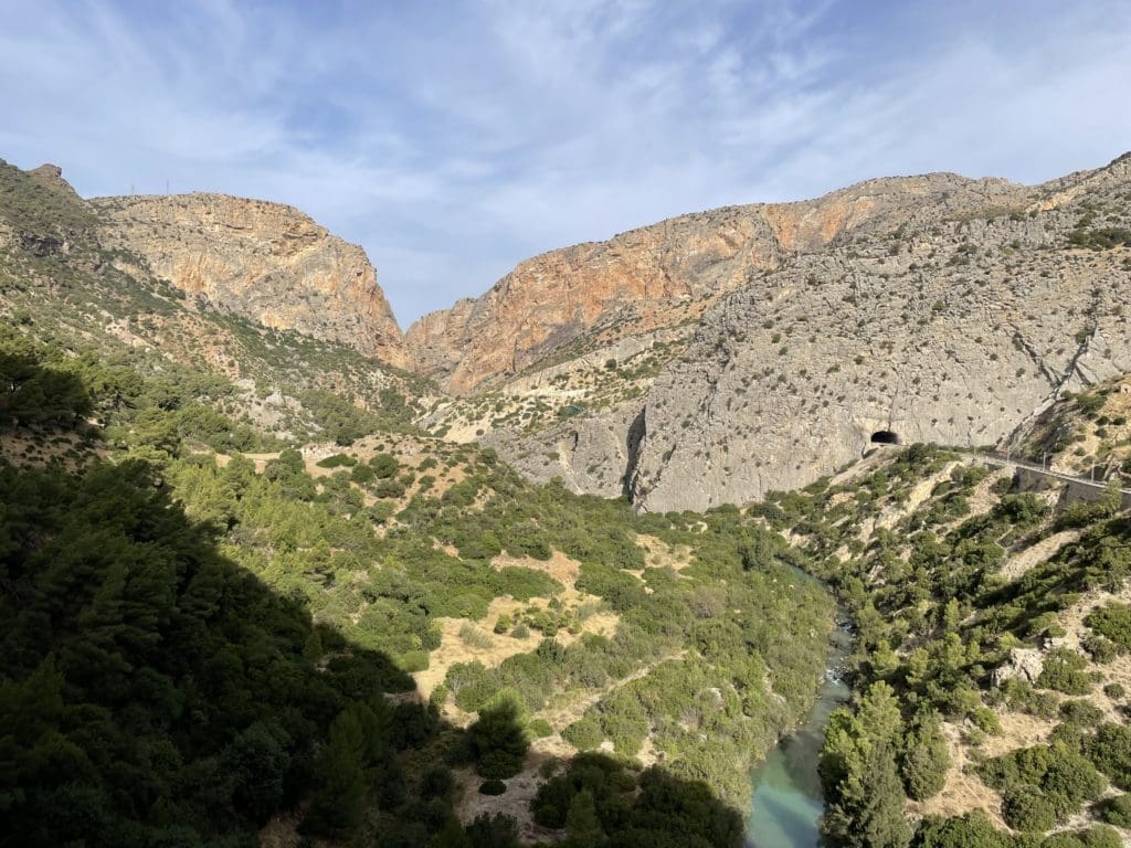
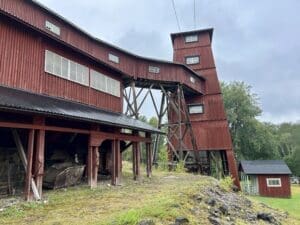
Caminito del Rey is located in the mountainous area of El Chorro, just over an hour's drive north-west of Málaga. The trail was originally built to enable workers to access the area for the hydroelectric power station built between 1901 and 1905 by engineer Rafael Benjumea. Water was piped through artificial lakes and aqueducts to the El Churro power station, which produced electricity for the people of Malaga. The construction of the power station was a dangerous project and many workers lost their lives over the years. In 1921, King Alfonso XIII came to visit and after that the area was named Caminito del Rey, the King's little road.
The hydropower plant was modernised and the trail lost its original purpose. It deteriorated further and became one of the most dangerous hiking trails in the world. After a number of deaths around 2000, the area was closed, only to reopen in 2015 after extensive renovations.


Entrance tickets can be purchased at the official website of the trail. website, but we chose to take a guided tour by bus directly from Málaga with the Alorature. It was both smooth and educational. We got a great guide who told us about the history of the place and had many funny anecdotes about his time as a guide. We quickly learnt that: "Don't be like Barbara!" Barbara is apparently a tourist who, during a previous tour, wandered off on her own and was not found when it was time to go home. It is somewhat unclear whether Barbara is the ghost running around naked in the area looking for tourists to eat or whether Barbara had to order a ridiculously expensive taxi ride to get home to Málaga. Either way, we would be careful not to do what Barbara did.
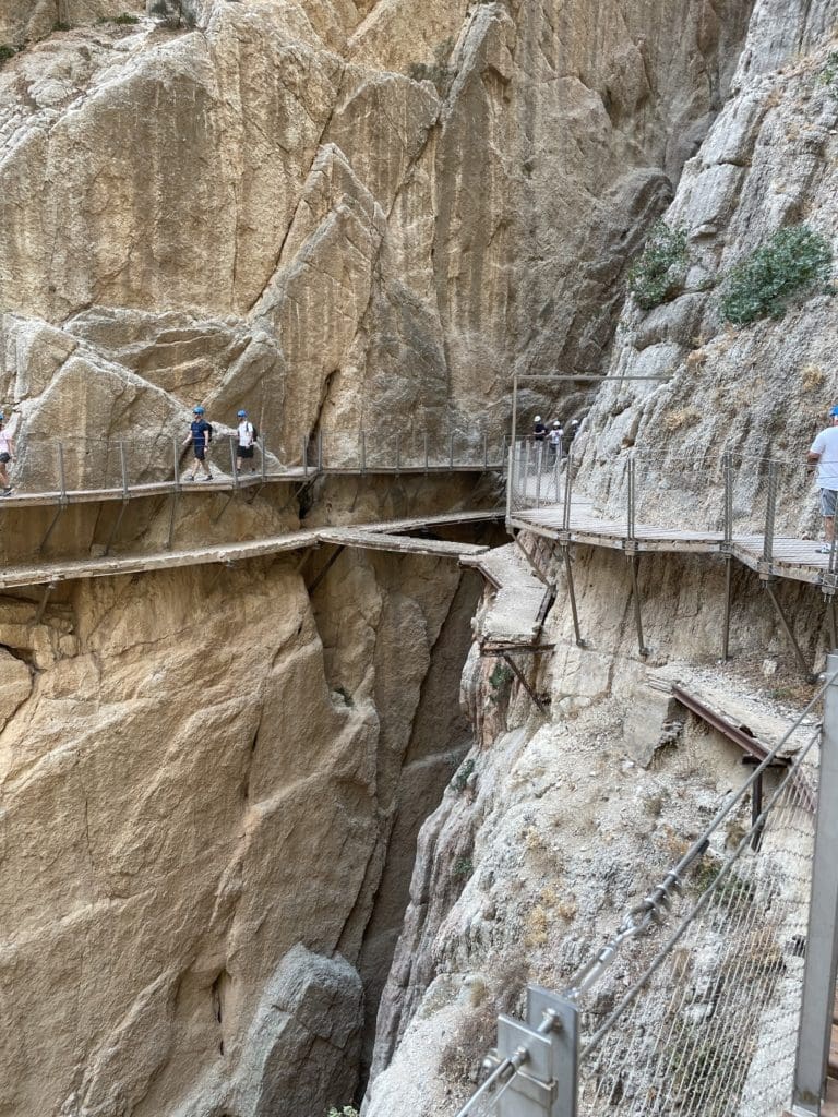

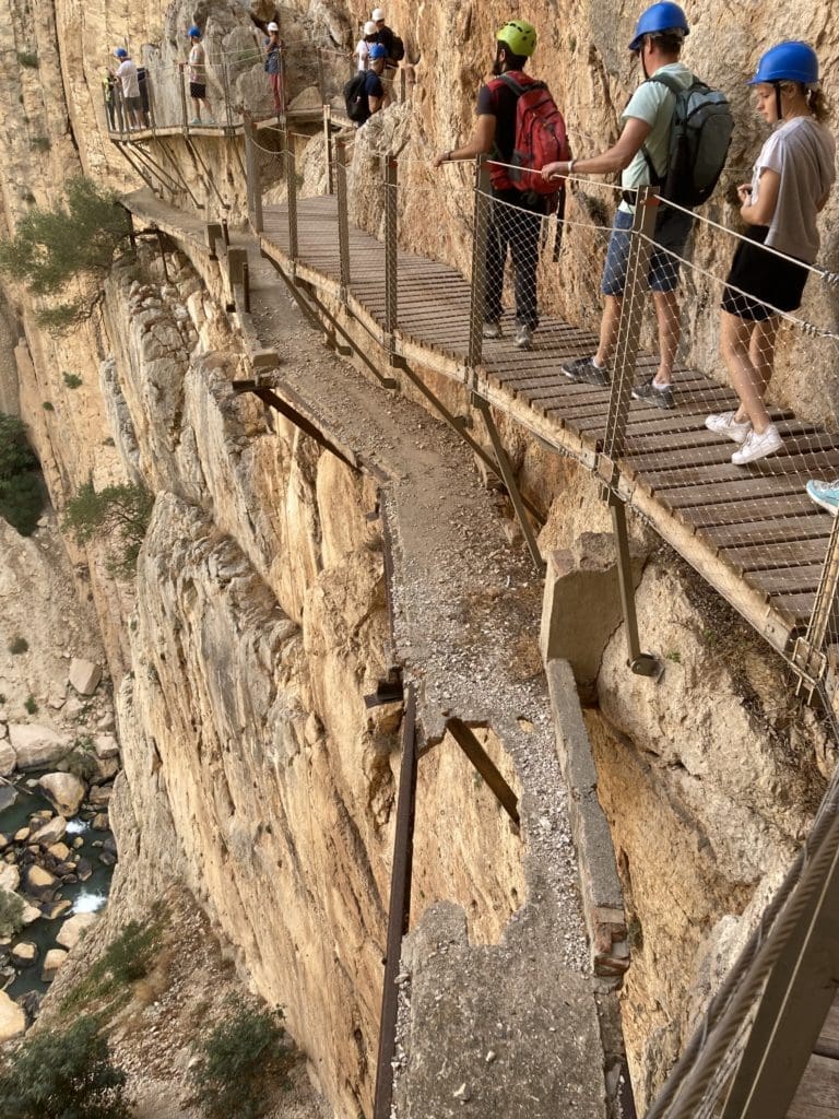
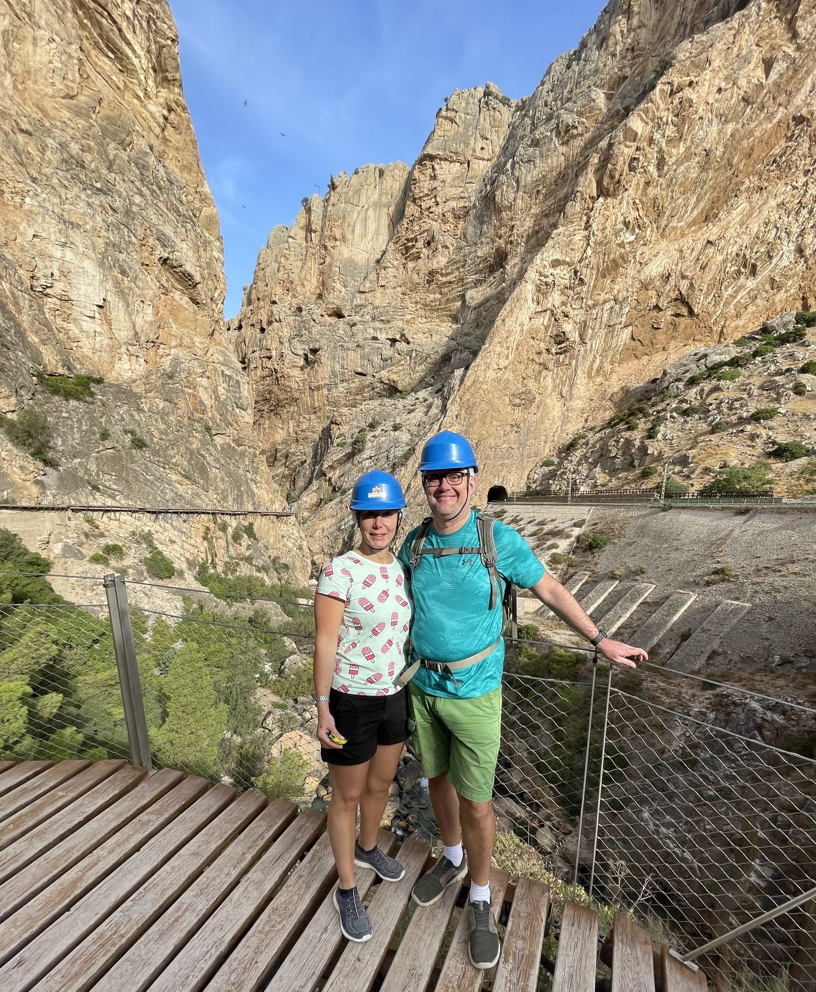
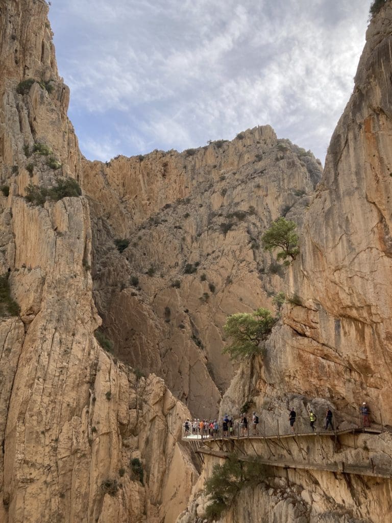
The hike itself is just over 7.5 kilometres long and about half of it is along the mountain wall. Before the hike, there is a short safety briefing and you are given a helmet that you must wear all the way. It is an easy hike but comfortable shoes, a water bottle and some snacks are good to have, there are no facilities along the way. If you come by car, keep in mind that the trail only goes one way so you have to take a bus back to the car park. We didn't have to worry about this as we took a guided tour, but the bus back to the car park is reportedly on a somewhat uncertain schedule.


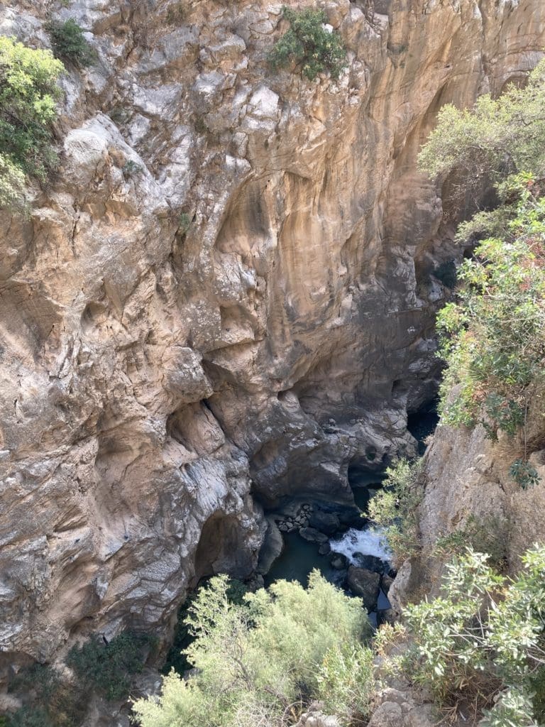
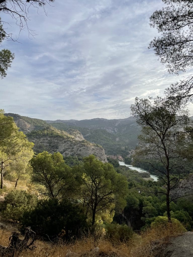
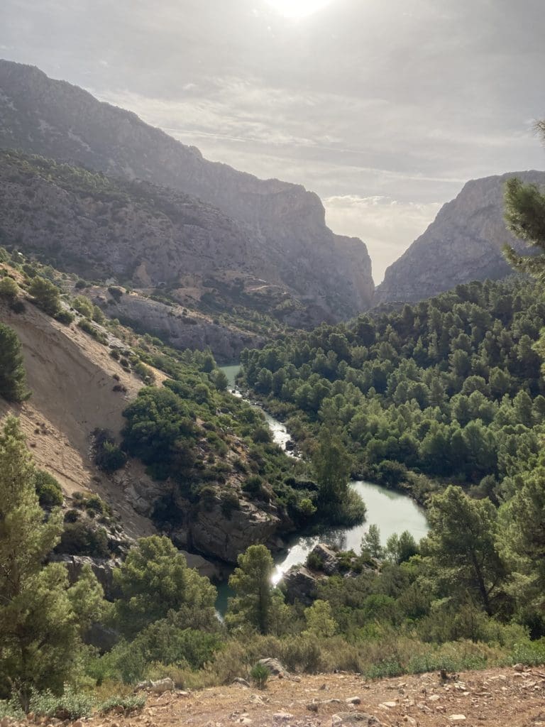
The hike was one of the coolest nature experiences I have had. Seeing the landscape with its deep ravines and the previous trails was truly breathtaking. It's hard to believe that an area like this exists in Europe. As usual, the pictures don't really do the place justice, but you can see here some of what we experienced on our hike.
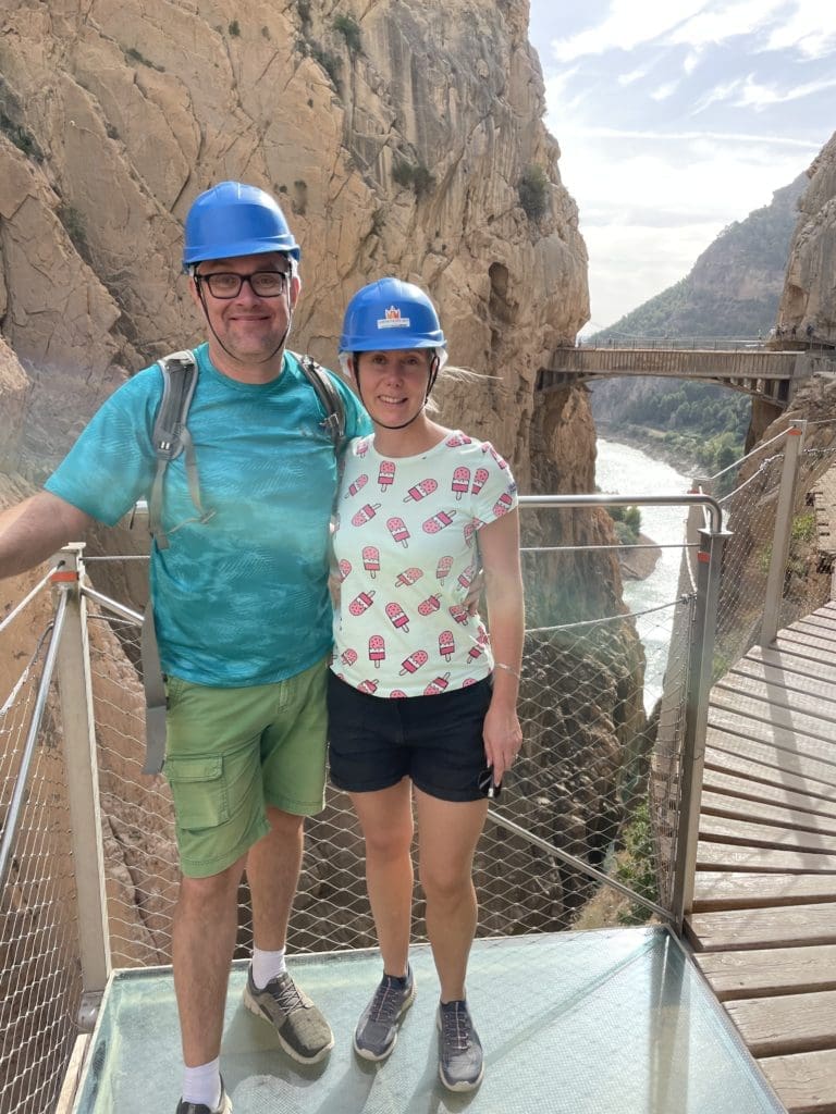
The tour ended with a walk across the 35 metre long suspension bridge that spans the Puente Colgante gorge. If you are afraid of heights, don't look down, it is 105 metres down to the bottom of the gorge. However, since the surface of the bridge is built as a grid, the view down is difficult to avoid. 🙂
Don't miss the Caminito del Rey next time you're in southern Spain!